
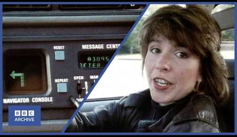
1986: Satellite Navigation for Cars of the Future | Tomorrow's World | Retro Tech | BBC Archive
The program showcased a prototype vehicle equipped with a large digital dashboard screen and an onboard computer using bubble memory to store digital maps and calculate navigational directions based on distance traveled and heading.
The report features Maggie Philbin visiting the Transport and Road Research Laboratory in Crowthorne, where two innovative in-car navigation systems were being tested. The first system was limited—it relied on static maps that quickly became outdated as new roads or traffic conditions changed, and it lacked rerouting capabilities. The second system, installed in a Range Rover, was far more sophisticated: it communicated with roadside computers embedded in loops under the road surface. These roadside units tracked traffic flow and fed real-time information back to the vehicle, allowing dynamic route updates and rerouting around congestion, accidents, or roadworks.
The range of technologies covered the early ideas about wireless communication between car and infrastructure, voice-guided directions, and the integration of onboard computers with external traffic management. Despite technical limitations and high implementation costs, the episode heralded a future where cars would interact with smart roads to reduce travel time and hassle.
This BBC archive footage provides a remarkable time capsule of early car navigation technology, showing how pioneering efforts in the 1980s laid groundwork for the GPS and real-time navigation systems common today. It highlights the challenges faced by early engineers and the ambition to make driving safer, simpler, and more efficient—goals that remain central to automotive innovation today.