
Tag: Graphics

Revealed: The streets where your car is most likely to get stolen or broken into... so how dangerous is YOUR neighbourhood?
Powered with data for every neighbourhood in England, the Mail's interactive map reveals how many car crimes are logged near your home.
I bought an EV to save money but it's costing me HUNDREDS more than running a diesel car - here's why
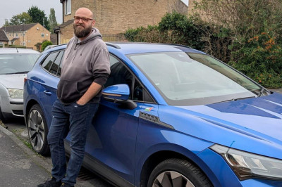
When Kristian Lewin-Petrov, 45, replaced his diesel car with an EV, he had grand visions of reducing his family's impact on the environment as well as lowering his driving bills.

Diesel's demise: Availability has plummeted by two thirds since 2020 - but one brand still has 16 diesel car options in showrooms today
If you're a fan of diesel cars, trying to find a new one in showrooms is rapidly turning into a needle in a haystack operation.

Where your stolen car ends up: A shipping container 'needle' found hidden in a vast 'haystack' of cargo - with £230,000 worth of stolen vehicles inside due to be shipped across the world
EXCLUSIVE: Hundreds of vehicles are snatched from streets and driveways across the UK every day, with many smuggled abroad to cities from Dubai and Moscow to Kinshasa.
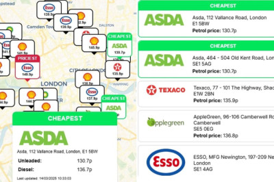
Cheapest place to buy petrol and diesel near you REVEALED... so could YOU save £10 by filling up at a different station down the road?
Motorists could save themselves hundreds of pounds a year just by filling up at a different petrol station. Our real-time petrol price map, has now made that challenge a great deal easier.
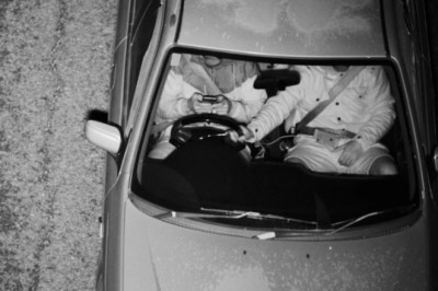
Beware the eye in the sky! AI traffic cop catches thousands of drivers texting behind the wheel
Whether it's sending a quick text or casting an eye over your emails, those tempted to look at their phone while driving are finally being caught out.

Dartford Crossing delays INCREASED after ministers hiked charges by 40% to 'manage traffic'
On 1 September, the one-off Dart Charge payment for car drivers was increased from £2.50 to £3.50 to reduce journey times, according to the DfT.

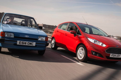
End of the road for the gearstick? Rising number of learners take driving tests in automatic cars due to rise of electric vehicles
Statistics from the Driver and Vehicle Standards Agency (DVSA) show that a quarter of the tests taken in England, Scotland and Wales last year were done in automatic.
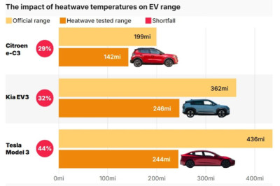
Electric car range almost halves when driving in heatwaves
A test by What Car? drove three popular EVs through the 'frying pan of Andalusia' in Spain, enduring temperatures between 32 and 44 degrees.
Britons' cars have never been OLDER: Average age of motors on the road reaches record high
A review of official vehicle registrations figures by the RAC Foundation found that the average car on the country's roads at the end of 2024 was nine years and 10 months.
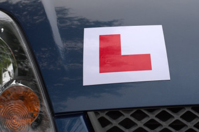
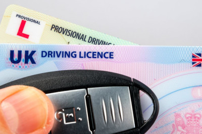
Learner drivers being exploited by brokers charging over DOUBLE the price for earlier tests
Learner drivers are being exploited by dodgy brokers charging more than double the price for an earlier test.
Do you have more points on your driving licence than your neighbours? Find out with our penalty postcode search tool
To use our interactive feature, enter your postcode and the number of points you have currently to see how you compare to other motorists in your area.

Revealed: The VERY strange ailments that are netting sufferers a brand-new car funded by the taxpayer
Motability was set up to provide cars for those with serious physical disabilities, but now people with VERY surprising conditions are using it to get around courtesy of taxpayers.

The Essex farm at the centre of an international car smuggling ring: How remote spot by the M25 is linked to London's car crime epidemic.. and its dark past as a hotbed for organised crime
EXCLUSIVE: Like many farms, Baldwins in south Essex is reached by winding lanes and surrounded by green fields.
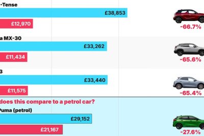
Electric cars that crash in value in a year: Some are worth just a THIRD of their new price after 12 months
Some electric cars are suffering such catastrophic depreciation that they shed tens of thousands of pounds after just a year. Here's a countdown of the 20 models losing value quickest.